Instrumentation
We use many different types of instruments to collect physical oceanographic
data. Here are summaries of them, and links to more information.
 |
Gliders The ART lab operates small fleet of 200-m electric Slocum gliders, which profile constantly between the surface and a target depth, and can navigate independently for weeks. We use them to perform high-resolution mapping of subsurface dynamic features in coastal waters around Alaska. Several are equipped with nutrient sensors in order to sample a suite of biogeochemical-physical parameters (salinity, temperature, pressure, nitrate, fluorescence, backscatter, and CDOM). |
|
 |
HF Radar UAF has employed High Frequency Radar systems to measure surface currents in Prince William Sound, Cook Inlet, the Beaufort Sea, and most recently, in the Chukchi Sea. Each system consists of 2 antennae: one that transmits a signal over the surface of the ocean, and another that receives the signal that bounces back. The shift in the frequency of the returning signal is used to determine currents over a wide area of the ocean's surface. |
|
 |
Remote Power To power the HF Radar sites, we've developed the Remote Power Module (RPM), a fully-automated, renewable (solar and wind) hybrid power station that is designed to operate in arctic and sub-arctic maritime environments. A rugged, durable, and climate controlled shelter houses the high-frequency radar electronics, communications equipment, and electrical system components of the power plant. Its compact footprint is amenable to the difficult permitting requirements in many remote coastal areas. |
|
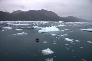 |
Drifters We have deployed a variety of drifters in Alaska and Greenland, including two ice-strengthened drifters equipped with Seabird microCATs in a large fjord system on the west coast of Greenland. |
|