2012 Drifters in Greenland
Introduction
In order to define the circulation and salinity structure in a large fjord system on the west coast of Greenland where measurements are difficult, we have deployed several ice-strengthened drifters equipped with Seabird microCATs. Two of the drifters measure salinity at 0, 7, and 15 m
In 2011, we deployed two of these drifters and developed a preliminary page to display that data.2013 drifter data is also now available.
This project is a collaboration between our school (the School of Fisheries and Ocean Sciences, UAF), the Geological Institute at UAF (Martin Truffer, Principal Investigator), and the Greenland Climate Research Center.
Measurements
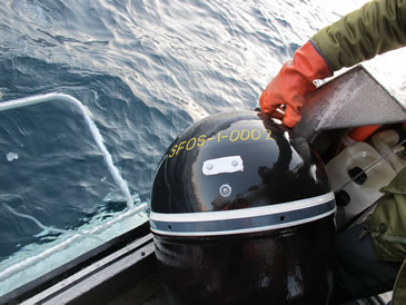
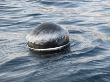
The drifters (manufactured by Pacific Gyre Inc.) are each equipped with Seabird MicroCAT temperature and salinity sensors at 3 depths - the surface, 7 m, and 15 m - to allow sampling of the upper-ocean stratification as well as circulation. A large drogue is below the deepest instrument, and the drifters have a high-accuracy GPS unit and "brain" in the surface sphere. Data is transmitted to us every 30 minutes via Iridium satellite. Instrument endurance is expected to be ~1 year, or longer if we recover them to replace the batteries.
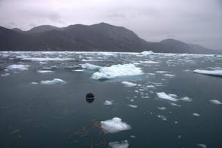
In 2012, the drifters were deployed by helicopter at the base of the glacier.
Project
The principal purpose of this project is to demonstrate the feasibility of instrumenting heavily ice-covered fjords to obtain real-time data of the upper ocean. The project is more fully described in the Drifting Buoys project page.
Data Tools
Map of Drifter Tracks
Above: A Google Map of Greenland with the drifter tracks included. Green push-pins indicate the drifters' deployment locations, and blue push-pins mark the current positions. Click on the icons for information about daily status and deployment objectives.