
Operational Partners
| CIAP The State of Alaska Coastal Impact Assistance Program (CIAP) is fully funding High Frequency Radar (HFR) and Remote Power Module (RPM) equipment at Cape Simpson on the Beaufort Sea. The addition of this field site provides coverage of surface current measurements around Point Barrow, into the Western Beaufort. |
|
| WHOI Dr. Robert Pickart, at the Woods Hole Oceanographic Institution (WHOI), is the co-PI in charge of the shelfbreak/slope component of this program. WHOI will deploy a set of moorings in the vicinity of the Beaufort Sea shelf break (east of Barrow Canyon) and the Chukchi Sea shelf break (west of Barrow Canyon) and conduct hydrographic surveys of the region. |
|
| NSBW We cooperate with Dr. Leandra de Sousa, at the North Slope Borough Department of Wildlife Management (NSBW), to process and display the data from their drifters. In 2012, there were 26 iSPHERE surface and 26 1m Microstar drifters deployed. |
|
| IOOS/AOOS The Alaska Ocean Observing System (AOOS) and the U.S. Integrated Ocean Observing System (IOOS) provide funds to support gliders and HFR. |
|
| NOAA/PMEL/EcoFOCI Dr. Phyllis Stabeno, at the National Oceanic and Atmospheric Administration's Pacific Marine Environmental Lab (NOAA PMEL), released several drifters in the Chukchi Sea in 2012, and has shared their data with us. They produce animations of all their drifter deployments. |
 |
| Industry Oil companies have deployed several moorings in the Chukchi Sea, including 3 Met-Ocean buoys, and share the data with us. |
 |
Other BOEM Projects
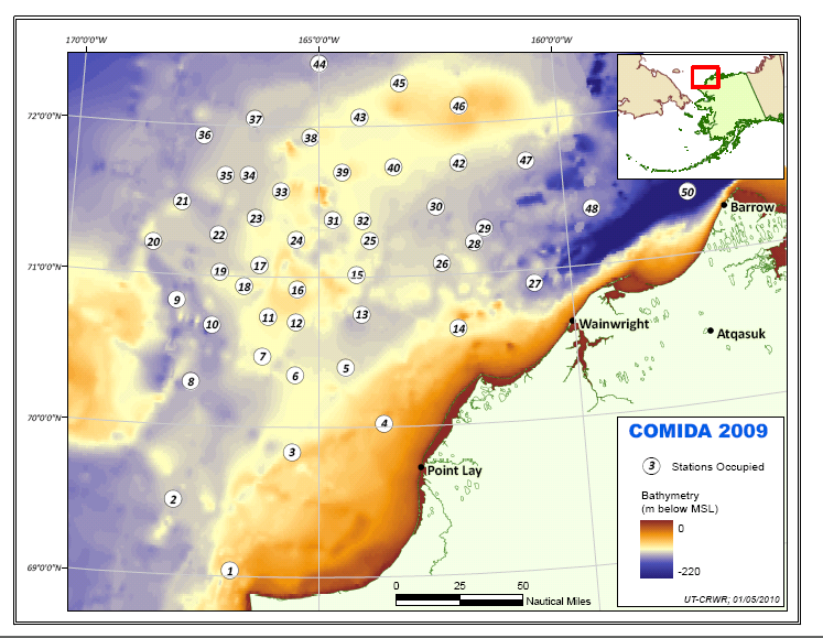
| Chukchi Sea Offshore Monitoring in Drilling Area (COMIDA) This interdisciplinary program includes hydrographic surveys over and around Hanna Shoal and the deployment of 6 oceanographic, subsurface moorings per year: three to the northwest and three to the northeast of the Shoal. The moorings, which measure currents, temperature, and salinity, will examine year-round circulation and water mass variability in this region. |
 |
| Polynyas "Mapping and Characterization of Recurring Spring Leads and Landfast ice in the Beaufort and Chukchi Seas" |
 |
| Walruses "Pinniped Movements and Foraging: Walrus Habitat Use in the Potential Drilling Area" |
 |
| Bowhead Whales "Bowhead Whale Feeding Variability in the Western Alaskan Beaufort Sea: Satellite Tracking of Bowhead Whales" |
 |
UAF Based Background Information
| ARTlab The Autonomous Remote Technology Laboratory, Institute of Marine Science (IMS), University of Alaska Fairbanks (ARTlab): descriptions of our instruments, other projects, and more tools that allow access to real-time data. |
 |
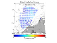
| Chukchi Sea Surface Currents Webpage with maps of surface currents from the High Frequency Radar |
 |
Arctic Summaries
| Arctic Sea Ice News and Analysis The National Snow and Ice Data Center (NSIDC) offers a monthly summary of the state of the Arctic Sea Ice, as well as daily maps of sea ice extent. |
 |
| Arctic Report Card The National Atmospheric and Oceanic Administration (NOAA) provides and annual summary of the current state of the Arctic relative to historical time records. |
 |