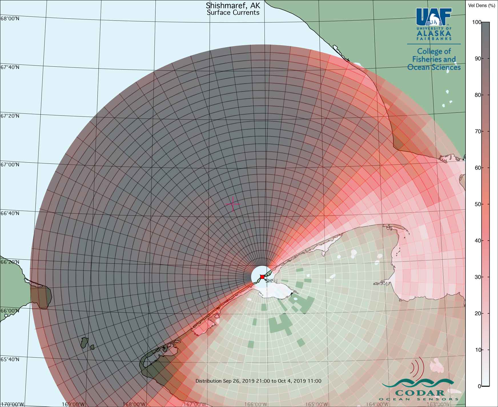
In September, UAF installed a high-frequency radar in Shishmaref to monitor surface currents in Bering Strait.
The figure below shows the coverage area measured by the system from Sep 26 - Oct 4.
Darker reds/gray colors mean more data returns than those that are light red/pink.
 |
|
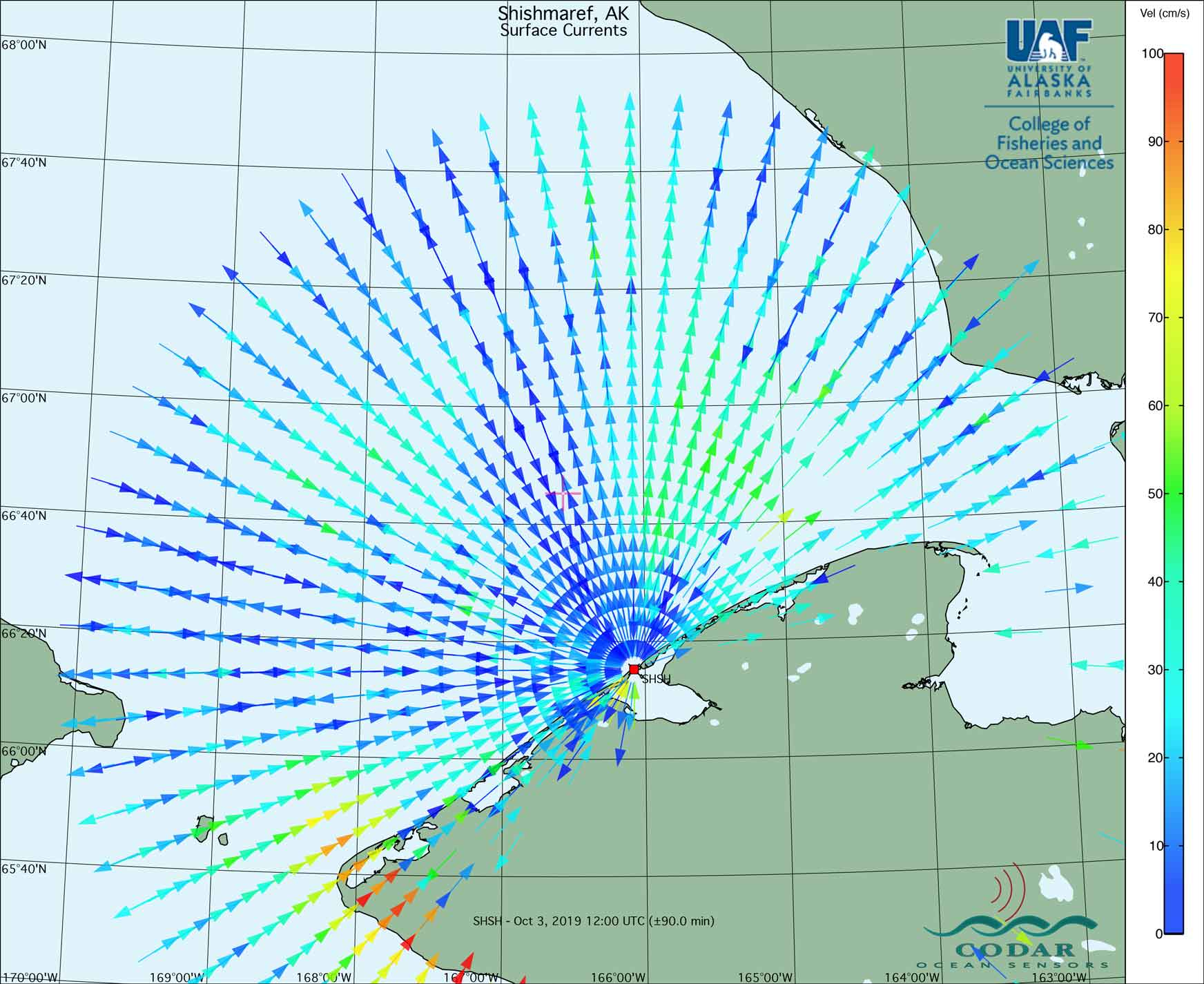
The data collected tells us whether ocean currents are moving toward or away from the site in Shishmaref.
The more blue the color, the slower the current, and the more red the color, the faster the current.
We are working to get all of the data collected on this web site.
The map below shows data recorded on Oct 3.
 |